Who We Are
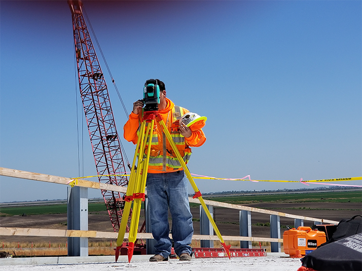
At Raju Land Survey, We are a team of dedicated land survey professionals with extensive experience in the field. Our experts combine cutting-edge technology with a deep understanding of land surveying principles to deliver precise and reliable results. We are committed to providing exceptional service and maintaining the highest standards of accuracy and integrity. Our passion for the industry and dedication to client satisfaction set us apart as a trusted partner for all your land surveying needs. Whether you’re embarking on a new development or resolving property disputes, we are here to ensure your project’s success.

What We Do
We specialize in delivering comprehensive land surveying services tailored to meet your specific needs. Our offerings include land surveys, topographical surveys, property boundary surveys, and more. Utilizing advanced technology and precise measurement techniques, we provide detailed and accurate survey reports that support your planning, development, and legal requirements. Our expert team ensures that every aspect of your land is thoroughly examined and documented. Our goal is to provide you with the insights and data you need for successful project execution and property management.

Why Choose Us
Choosing Raju Land Survey, means partnering with a team that prioritizes accuracy, professionalism, and client satisfaction. Our skilled surveyors use state-of-the-art equipment and methodologies to deliver precise, reliable results that you can trust us and get better results. We are committed to clear communication and timely service, ensuring that your project stays on track and within budget, We offer unmatched expertise in every survey we conduct. Trust us to provide the detailed, high-quality survey data you need for confident decision-making and successful outcomes.

Who We Are
At Raju Land Survey, We are a team of dedicated land survey professionals with extensive experience in the field. Our experts combine cutting-edge technology with a deep understanding of land surveying principles to deliver precise and reliable results. We are committed to providing exceptional service and maintaining the highest standards of accuracy and integrity. Our passion for the industry and dedication to client satisfaction set us apart as a trusted partner for all your land surveying needs. Whether you’re embarking on a new development or resolving property disputes, we are here to ensure your project’s success.

What We Do
We specialize in delivering comprehensive land surveying services tailored to meet your specific needs. Our offerings include land surveys, topographical surveys, property boundary surveys, and more. Utilizing advanced technology and precise measurement techniques, we provide detailed and accurate survey reports that support your planning, development, and legal requirements. Our expert team ensures that every aspect of your land is thoroughly examined and documented. Our goal is to provide you with the insights and data you need for successful project execution and property management.

Why Choose Us
Choosing Raju Land Survey means partnering with a team that prioritizes accuracy, professionalism, and client satisfaction. Our skilled surveyors use state-of-the-art equipment and methodologies to deliver precise, reliable results that you can trust us and get better results. We are committed to clear communication and timely service, ensuring that your project stays on track and within budget, We offer unmatched expertise in every survey we conduct. Trust us to provide the detailed, high-quality survey data you need for confident decision-making and successful outcomes.

Who We Are
At Raju Land Survey, We are a team of dedicated land survey professionals with extensive experience in the field. Our experts combine cutting-edge technology with a deep understanding of land surveying principles to deliver precise and reliable results. We are committed to providing exceptional service and maintaining the highest standards of accuracy and integrity. Our passion for the industry and dedication to client satisfaction set us apart as a trusted partner for all your land surveying needs. Whether you’re embarking on a new development or resolving property disputes, we are here to ensure your project’s success.

What We Do
We specialize in delivering comprehensive land surveying services tailored to meet your specific needs. Our offerings include land surveys, topographical surveys, property boundary surveys, and more. Utilizing advanced technology and precise measurement techniques, we provide detailed and accurate survey reports that support your planning, development, and legal requirements. Our expert team ensures that every aspect of your land is thoroughly examined and documented. Our goal is to provide you with the insights and data you need for successful project execution and property management.

Why Choose Us
Choosing Raju Land Survey means partnering with a team that prioritizes accuracy, professionalism, and client satisfaction. Our skilled surveyors use state-of-the-art equipment and methodologies to deliver precise, reliable results that you can trust us and get better results. We are committed to clear communication and timely service, ensuring that your project stays on track and within budget, We offer unmatched expertise in every survey we conduct. Trust us to provide the detailed, high-quality survey data you need for confident decision-making and successful outcomes.
